Windermere Way
| Use attributes for filter ! | |
| Length | 72 km |
|---|---|
| Highest point | Wansfell |
| Date of Reg. | |
| Date of Upd. | |
| ID | 4059303 |
About Windermere Way
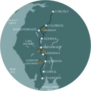
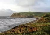
The Windermere Way is a 45-mile circuit of Windermere, a lake in the English Lake District. The route is wholly within the Lake District National Park and takes in the summits of Wansfell, Loughrigg Fell and Gummer's How as well as passing through the towns of Ambleside and Windermere.
Where is the Windermere Way
Click on the photo of Windermere Way to view it on Google Maps.