Peters Mountain
| Use attributes for filter ! | |
| Elevation | 1,241 m |
|---|---|
| Prominence | 376 m |
| Mountain range | Allegheny Mountains |
| Regions | Alleghany County |
| Parent range | Allegheny Mountains |
| Topo map | USGS |
| Ratings | 4.3 |
| Rang coordin | 37°36′24″N 80°14′27″W / 37.60667°N 80.24083°W |
| Date of Reg. | |
| Date of Upd. | |
| ID | 2240676 |
About Peters Mountain
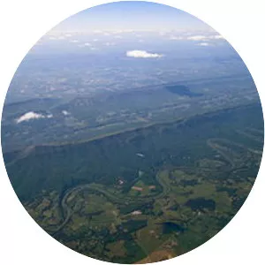
Peters Mountain is a 52-mile mountain in the U.S. states of Virginia and West Virginia. It is located on the border between Alleghany County, VA, Monroe County, WV, Giles Co., VA, and Craig Co., VA. Its elevation ranges from 4,073 feet on the mountaintop to a low of 2,300 feet.
Where is the Peters Mountain
Click on the photo of Peters Mountain to view it on Google Maps.