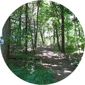
Warner Trail
| Use attributes for filter ! | |
| Address | 207 Edge Hill Rd, Sharon, MA 02067, United States |
|---|---|
| Highest point | Moose Hill |
| Lowest point | Canton |
| Date of Reg. | |
| Date of Upd. | |
| ID | 2940246 |
About Warner Trail
The Warner Trail is a 30 mi New England hiking trail which extends from Diamond Hill in the northeast corner of Rhode Island northeast through Norfolk County, Massachusetts to Canton, 13 miles south of Boston.
Where is the Warner Trail

Click on the photo of Warner Trail to view it on Google Maps.