Tug Fork
| Use attributes for filter ! | |
| Length | 256 km |
|---|---|
| Mouth | Big Sandy River |
| ⁃ average | 1,457 cu ft/s (41. 3 m3/s) |
| Source | Appalachian Mountains |
| ⁃ left | Dry Fork |
| Panther Creek | |
| Regions | McDowell County |
| Buchanan County | |
| Pike County | |
| Mingo County | |
| Martin County | |
| Lawrence County | |
| Wayne County | |
| Date of Reg. | |
| Date of Upd. | |
| ID | 2432916 |
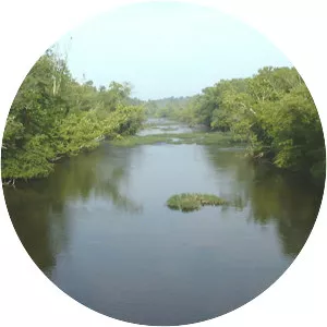
About Tug Fork
The Tug Fork is a tributary of the Big Sandy River, 159 miles long, in southwestern West Virginia, southwestern Virginia, and eastern Kentucky in the United States. Via the Big Sandy and Ohio rivers, it is part of the watershed of the Mississippi River. It is also known as the Tug Fork River.