Superior Hiking Trail
| Use attributes for filter ! | |
| Length | 310 mi (499 km) |
|---|---|
| Highest point | 1,829 ft (557 m) |
| Trailheads | Jay Cooke State Park |
| Canada–US border | |
| Lake Superior | |
| Locations | Cook |
| Lake | |
| Saint Louis | |
| Carlton | |
| Minnesota | |
| United States | |
| Season | spring |
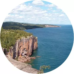
| Sights | Lake Superior |
| Iron Range | |
| Date of Reg. | |
| Date of Upd. | |
| ID | 1000919 |
About Superior Hiking Trail
The Superior Hiking Trail, also known as the SHT, is a 310-mile long footpath in northeastern Minnesota that follows the ridgeline overlooking Lake Superior for most of its length. The path is 18 inches wide and is set in the middle of a 4-foot clearing.