Sunset Crater
| Use attributes for filter ! | |
| Last eruption | 1085 |
|---|---|
| Elevation | 2,451 m |
| Locations | Coconino County |
| Arizona | |
| Coconino County, Arizona, U.S. | |
| Established | May 26, 1930 |
| Topo map | USGS |
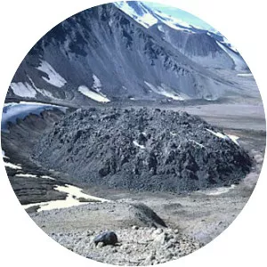
| Did you know | The largest vent of the eruption, Sunset Crater itself, was the source of the Bonito and Kana-a lava flows that extended about 2. 5 kilometers (1. 6 mi) NW and 9. 6 kilometers (6 mi) NE, respectively. |
| Ratings | 4.6 |
| Prominence | 340 m |
| Last erupt | 1075 ± 25 years |
| Established date | May 26, 1930 |
| Mountain range | San Francisco volcanic field |
| Management | National Park Service |
| Date of Reg. | |
| Date of Upd. | |
| ID | 1136048 |
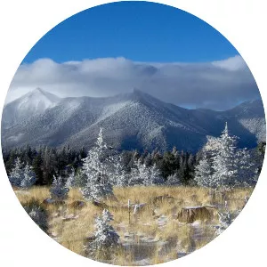
About Sunset Crater
Sunset Crater is a cinder cone located north of Flagstaff in the U.S. state of Arizona. The crater is within the Sunset Crater Volcano National Monument. Sunset Crater is the youngest in a string of volcanoes that is related to the nearby San Francisco Peaks.
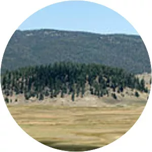
Where is the Sunset Crater
Click on the photo of Sunset Crater to view it on Google Maps.