Steep Holm
| Use attributes for filter ! | |
| Civil parish | Weston-super-Mare |
|---|---|
| Ceremonial county | Somerset |
| Unitary authority | North Somerset |
| Highest point | 78 m (256 ft) |
| Length | 1 km (0. 6 mi) |
| Date of Reg. | |
| Date of Upd. | |
| ID | 1272316 |
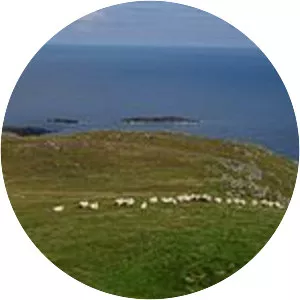
About Steep Holm
Steep Holm is an English island lying in the Bristol Channel. The island covers 48. 87 acres at high tide, expanding to 63. 26 acres at mean low water. At its highest point it is 78 metres above mean sea level. It lies within the historic boundaries of Somerset and administratively forms part of North Somerset.