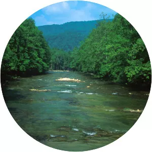
Shavers Fork
| Use attributes for filter ! | |
| Length | 143 km |
|---|---|
| Source | Pocahontas County |
| Basin size | 214 sq mi (550 km2) |
| Country | United States |
| Mouths | Cheat River |
| Parsons | |
| Regions | Tucker County |
| Randolph County | |
| Pocahontas County | |
| Date of Reg. | |
| Date of Upd. | |
| ID | 3004085 |
About Shavers Fork
Shavers Fork of the Cheat River is situated in the Allegheny Mountains of eastern West Virginia, USA. It is 88. 5 mi long and forms the Cheat at its confluence with Black Fork at Parsons.