Pontcysyllte Aqueduct
| Use attributes for filter ! | |
| Address | Station Rd, Trevor Basin, Wrexham LL20 7TG, UK |
|---|---|
| Height | 3800 (cm) |
| Clearance below | 38 m |
| Hours | Open 24 hours |
| Water depth | 5 ft 3 in (1. 60 m) |
| Did you know | Pontcysyllte Aqueduct was built to carry what's now known as the Llangollen canal across the river Dee valley. |
| Date of Reg. | |
| Date of Upd. | |
| ID | 940490 |
About Pontcysyllte Aqueduct
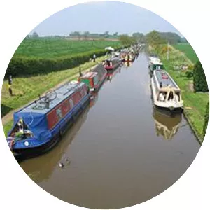
The Pontcysyllte Aqueduct is a navigable aqueduct that carries the Llangollen Canal across the River Dee in the Vale of Llangollen in north east Wales. The 18-arched stone and cast iron structure is for use by narrowboats and was completed in 1805 having taken ten years to design and build.
Where is the Pontcysyllte Aqueduct

Click on the photo of Pontcysyllte Aqueduct to view it on Google Maps.


Pontcysyllte Aqueduct Photos