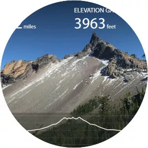
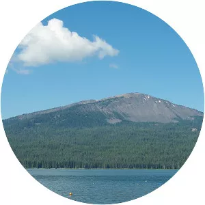
Mount Mazama
| Use attributes for filter ! | |
| Last eruption | 2290 BC |
|---|---|
| Elevation | 2487 |
| Mountain range | Cascade Range |
| Volcanic arc | Cascade Volcanoes |
| Topo map | USGS |
| Crater Lake | |
| Did you know | Mount Mazama rose to an approximate height of 3,700 m (12,000 ft) above sea level. |
| Date of Reg. | |
| Date of Upd. | |
| ID | 735310 |
About Mount Mazama
Mount Mazama is a complex volcano in the Oregon segment of the Cascade Volcanic Arc and the Cascade Range, in the United States, that was destroyed due to a major eruption that took place 7,700 years ago.