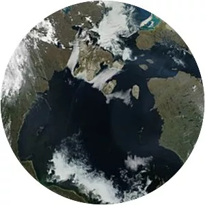
Labrador Sea
| Use attributes for filter ! | |
| Area | 841000 |
|---|---|
| Coordinates | 61°N 56°W / 61°N 56°W Coordinates: 61°N 56°W / 61°N 56°W |
| Max. depth | 4,316 m (14,160 ft) |
| Max. width | c. 900 km (559 mi) |
| Average depth | 1,898 m (6,227 ft) |
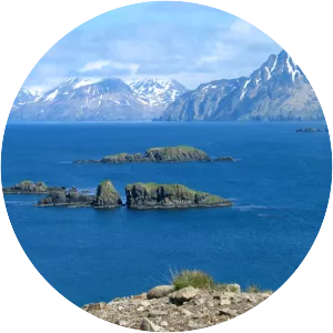
| Islands | Brevoort Island |
| Little Hall Island | |
| Muingmak Island | |
| Ilikok Island | |
| Leconte Island | |
| Date of Reg. | |
| Date of Upd. | |
| ID | 3001495 |
About Labrador Sea
The Labrador Sea is an arm of the North Atlantic Ocean between the Labrador Peninsula and Greenland. The sea is flanked by continental shelves to the southwest, northwest, and northeast. It connects to the north with Baffin Bay through the Davis Strait. It has been described as a marginal sea of the Atlantic.