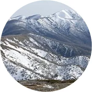
Hamersley Range
| Use attributes for filter ! | |
| Elevation | 1249 |
|---|---|
| Highest point | Mount Meharry |
| Country | Australia |
| Regions | Pilbara |
| Range coordinates | 21°53′S 116°46′E / 21. 883°S 116. 767°E Coordinates: 21°53′S 116°46′E / 21. 883°S 116. 767°E |
| Date of Reg. | |
| Date of Upd. | |
| ID | 2428517 |
About Hamersley Range
The Hamersley Range is a mountainous region of the Pilbara region of Western Australia. The range was named on 12 June 1861 by explorer Francis Thomas Gregory after Edward Hamersley, a prominent promoter of his exploration expedition to the northwest.