Grijalva River
| Use attributes for filter ! | |
| Length | 480 km |
|---|---|
| Discharge | 2,750 m³/s |
| Basin area | 134400 |
| Source | Chiapas Highlands |
| Mouth | Gulf of Mexico |
| Cities | Villahermosa |
| Date of Reg. | |
| Date of Upd. | |
| ID | 3022959 |
About Grijalva River
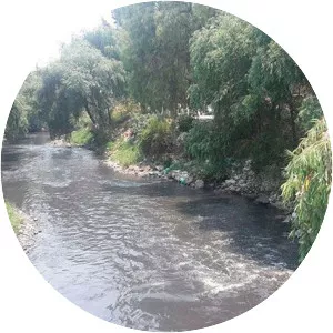
Grijalva River, formerly known as Tabasco River. is a 480 km long river in southeastern Mexico. It is named after Juan de Grijalva who visited the area in 1518. The river rises in Chiapas highlands and flows from Chiapas to the state of Tabasco through the Sumidero Canyon into the Bay of Campeche.