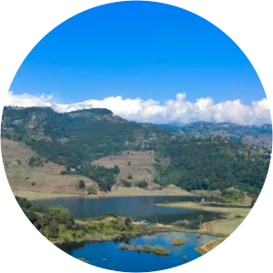
Ghodaghodi Lake
| Use attributes for filter ! | |
| Area | 2563 |
|---|---|
| Surface elevation | 205 |
| Locations | Kailali |
| Nepal | |
| Average depth | 4 m (13 ft) |
| Reference no | 1314 |
| Designated as world heritage site | August 13, 2003 |
| Date of Reg. | |
| Date of Upd. | |
| ID | 3038139 |
About Ghodaghodi Lake
Ghodaghodi Tal is a Ramsar site in western Nepal. Established in August 2003 it covers an area of 2,563 ha in Kailali District at an altitude of 205 m on the lower slopes of the Siwalik Hills.