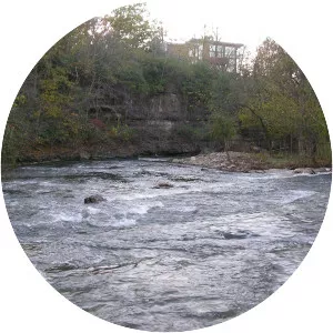
Floyds Fork
| Use attributes for filter ! | |
| Length | 99. 8 km |
|---|---|
| Mouth | Salt River |
| Country | United States |
| Date of Reg. | |
| Date of Upd. | |
| ID | 2481517 |
About Floyds Fork
Floyds Fork is a 62-mile-long tributary of the Salt River in Kentucky, directly south and east of Louisville. It begins in Henry County, near Smithfield Kentucky, flows through eastern Jefferson County and flows into the Salt River near Shepherdsville in Bullitt County.