Confusion Hill Bridges
| Use attributes for filter ! | |
| Locations | Mendocino County |
|---|---|
| Cross | South Fork Eel River |
| Height | 4300 (cm) |
| Materials | Concrete |
| Steel | |
| Date of Reg. | |
| Date of Upd. | |
| ID | 3141854 |
About Confusion Hill Bridges
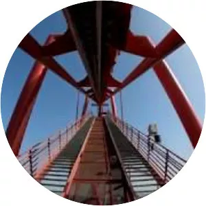
The Confusion Hill Bridges are a pair of high bridges carrying two lanes of U. S. Route 101 over the South Fork Eel River in Mendocino County in the U. S. state of California. The bridges were constructed to reroute approximately 1. 7 miles of the highway away from a massive landslide area on the south bank of the river.