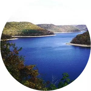
Caney Fork
| Use attributes for filter ! | |
| Length | 230 km |
|---|---|
| ⁃ average | 3,177 cu ft/s (90. 0 m3/s)(mean for water years 1915-1983) |
| Source | Cumberland Plateau |
| ⁃ location | Great Falls Dam |
| Basin size | 1,771 sq mi (4,590 km2) |
| Mouths | Cumberland River |
| Old Hickory Lake | |
| Date of Reg. | |
| Date of Upd. | |
| ID | 2989924 |
About Caney Fork
The Caney Fork River is a river that flows through central Tennessee in the United States, draining a substantial portion of the southwestern Cumberland Plateau and southeastern Highland Rim regions. It is a major tributary of the Cumberland River, and is part of the Cumberland, Ohio and Mississippi basins.