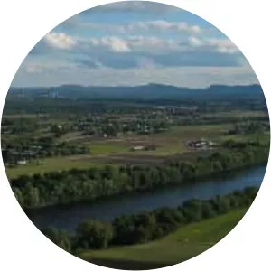
Ashuelot River
| Use attributes for filter ! | |
| Length | 103 km |
|---|---|
| Source | Butterfield Pond |
| Mouth | Connecticut River |
| Country | United States |
| Regions | Monadnock Region |
| Bridges | Sawyers Crossing Covered Bridge aka Cresson Bridge |
| Date of Reg. | |
| Date of Upd. | |
| ID | 3019092 |
About Ashuelot River
The Ashuelot River is a tributary of the Connecticut River, approximately 64 miles long, in southwestern New Hampshire in the United States. It drains a mountainous area of 425 square miles, including much of the area known as the Monadnock Region.